

DARPA has awarded a contract for the third and final phase of its Advanced RF Mapping program, known as RadioMap, which seeks to provide real-time awareness of radio spectrum use across frequency, geography and time. Akin to smartphone maps that show color-coded current traffic conditions, RadioMap is developing technology that visually overlays spectrum information on a map enabling rapid frequency deconfliction and maximizing use of available spectrum for communications and intelligence, surveillance and reconnaissance (ISR) systems.
Lockheed Martin Corp. in Manassas, Virginia, was recently awarded an $11.8 million Phase 3 contract to further develop technology from Phases 1 and 2 into a full system suitable for transition to the military services.
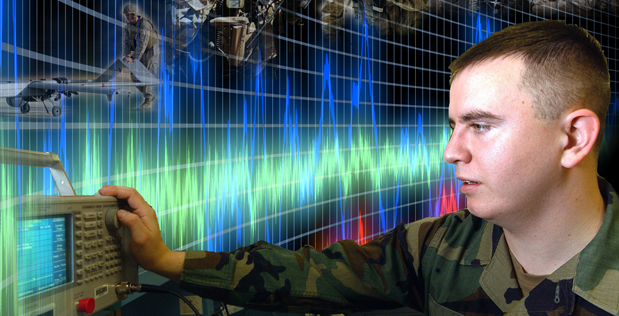
Today’s interconnected wireless world has led to congested airwaves, making Radio Frequency (RF) management a hot topic. For military members around the globe, efficiently managing the congested RF spectrum is critical to ensure effective communications and intelligence gathering.
The map can be likened to traffic cams in busy cities that show the flow of traffic at different times of the day, giving real-time awareness of whether a section of road is jammed with traffic or clear, helping drivers plan their commute. Such systems aren’t designed to show specific licenses plates or vehicle types, but rather are designed to help see and avoid congestion, resulting in smoother traffic flow. RadioMap isn’t designed to deal with specifics of transmissions, rather its purpose is to identify frequency usage—where and when the radio frequency “highway” is jammed or clear—allowing better planning and allocation of the spectrum to warfighters overseas operating in RF congested environments.
Another goal of the RadioMap program is to assist small tactical units such as platoons or companies that rarely carry equipment for monitoring radio emissions. With RadioMap, the radios already carried by these units would do double duty to inform the troops about nearby threats and opportunities that are visible in the RF spectrum.
“RadioMap adds value to existing radios, jammers and other RF electronic equipment used by our military forces in the field,” said John Chapin, DARPA program manager. “This program doesn’t require purchasing new spectrum-sensing devices. Rather, it uses existing radios and jammers that do double-duty. In the ‘down’ time when they aren’t performing their primary function, the devices sense the spectrum around them and, through RadioMap technology, provide an accurate picture of what frequencies are currently in use and where.”
RadioMap seeks to make spectrum management more efficient by giving operators the tools to see real and potential frequency interference and usage. For example, a forward-deployed unit might reserve a particular frequency for a communications link at a specific time, but due to the dynamic nature of the situation, the frequency ends up not being needed. RadioMap’s real-time visualization of actual spectrum use helps spectrum managers detect the unused frequency and enhance mission effectiveness by quickly reusing it for other needs.
RadioMap can also support small units—such as squads or platoons, which rarely carry equipment for monitoring radio emissions—by identifying nearby RF Spectrum emitters that may indicate tactical threats or opportunities.
“The Marine Corps is an ideal transition partner for RadioMap,” Chapin said. “They have in place the doctrine, organizational structure, and information systems framework that can effectively integrate RadioMap software. After successful tests at Quantico Marine Base in Phase 2 of RadioMap, I look forward to further collaboration and to transitioning the technology to Marine Corps use at the end of Phase 3.”
The base period of RadioMap Phase 3 is scheduled to continue through summer of 2016. If the Marine Corps test of the system in summer 2016 is successful, the program could transition to the Marine Corps after further operational testing in early 2017.

Brian Wang is a Futurist Thought Leader and a popular Science blogger with 1 million readers per month. His blog Nextbigfuture.com is ranked #1 Science News Blog. It covers many disruptive technology and trends including Space, Robotics, Artificial Intelligence, Medicine, Anti-aging Biotechnology, and Nanotechnology.
Known for identifying cutting edge technologies, he is currently a Co-Founder of a startup and fundraiser for high potential early-stage companies. He is the Head of Research for Allocations for deep technology investments and an Angel Investor at Space Angels.
A frequent speaker at corporations, he has been a TEDx speaker, a Singularity University speaker and guest at numerous interviews for radio and podcasts. He is open to public speaking and advising engagements.